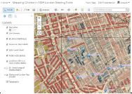
I have created an activity that focuses on analyzing cholera in 1854 London using web mapping tools–ArcGIS Online.
Analyzing cholera in 1854 London using web GIS.
Activities include buffering water pumps, determining how many deaths within a certain distance of the water pumps, finding the nearest pump to each death, and planning a route for Dr Snow and Reverend Whitehead to visit each house and each pump.