10 Ways to teach about climate using interactive maps and GIS.
See these 10 Ways via this story map.

Guess where?
10 Ways to teach about climate using interactive maps and GIS.
See these 10 Ways via this story map.
Guess where?
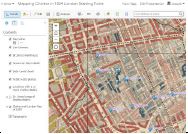
I have created an activity that focuses on analyzing cholera in 1854 London using web mapping tools–ArcGIS Online. Analyzing cholera in 1854 […]
Learn how geographic thinking and geographic technology are addressing the world’s most complex problems from local to global scale, including those in […]
My workshops and resources to support spatial thinking and GIS at New Mexico State University: Workshop: Collecting, mapping, analyzing, and communicating the […]
Syllabus: BioBlitz Workshop: Colorado State University Author: Joseph J. Kerski, Ph.D., GISP Goals: Through this workshop, you will: (1) Learn what GIS […]