Skip to content
Back Home
Joseph Kerski, Ph.D. GISP
  • Who I Am
    • Interview with Augmented Reality Solutions ArGIS Solutions Inc
    • Day of Geography Spotlight
    • My Interview with GIS User magazine, December 2015
    • Faculty Spotlight Interview: University of Denver
    • Interview with GeoJobe
    • Interview with Online Learning Consortium
    • Interview with “The Primary Geographer”
    • Interview with “Self Publishing Experts”
    • Interview with GIM International
    • My Dad: James J. Kerski
  • What I Believe
  • What I Do
  • Resources
    • Web and Story Maps
    • Spatial Thinking
    • GeoTech in Education
    • Curriculum
    • T3G Institute
    • Teaching
    • Videos
    • Geoinspirations with Joseph Kerski
  • Publications
  • Geo-Geekiness
    • My Earthcache: Gazing Across the Plate Boundary
    • Pointed Journeys: The Degree Confluence Project
    • To the nth Degree – Exploration Article
  • Photos & Videos
  • Podcast
  • Search
Back Home
Joseph Kerski, Ph.D. GISP
  • Search
  • Who I Am
    • Interview with Augmented Reality Solutions ArGIS Solutions Inc
    • Day of Geography Spotlight
    • My Interview with GIS User magazine, December 2015
    • Faculty Spotlight Interview: University of Denver
    • Interview with GeoJobe
    • Interview with Online Learning Consortium
    • Interview with “The Primary Geographer”
    • Interview with “Self Publishing Experts”
    • Interview with GIM International
    • My Dad: James J. Kerski
  • What I Believe
  • What I Do
  • Resources
    • Web and Story Maps
    • Spatial Thinking
    • GeoTech in Education
    • Curriculum
    • T3G Institute
    • Teaching
    • Videos
    • Geoinspirations with Joseph Kerski
  • Publications
  • Geo-Geekiness
    • My Earthcache: Gazing Across the Plate Boundary
    • Pointed Journeys: The Degree Confluence Project
    • To the nth Degree – Exploration Article
  • Photos & Videos
  • Podcast
Home » Uncategorized » Examining USGS Historical Topographic Maps with Online Tools
Uncategorized

Examining USGS Historical Topographic Maps with Online Tools

by jjk|Published 7 March 2016

I recently gave a presentation where I detailed the major and most useful ways by which you can examine Examining USGS Historical Topographic Maps with Online Tools.

–Joseph Kerski
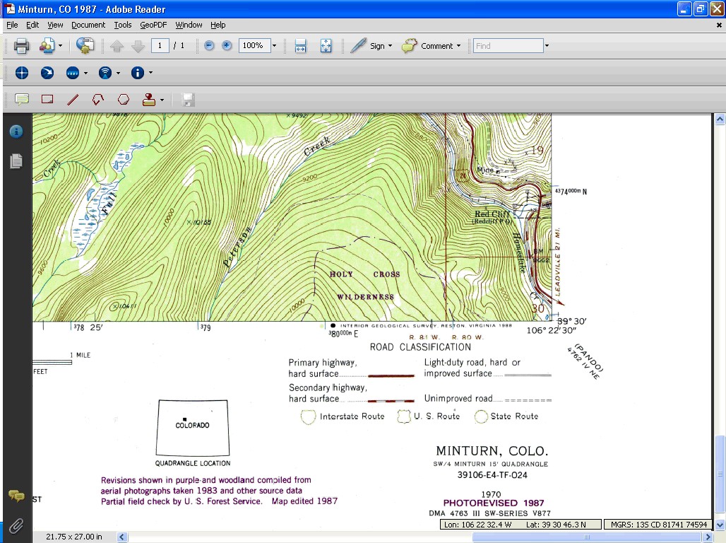
Topographic Map of Minturn
Topographic Map of Minturn, Colorado.


You may also like

Resources for Earth Day and Beyond:  Enviro-Geo-Tech Education
Published 23 April 2014

Resources for Earth Day and Beyond: Enviro-Geo-Tech Education

A few key resources for Earth Day and in the future: (1)  Mapping the Environment:  10 resources: http://blogs.esri.com/esri/gisedcom/2013/10/18/mapping-the-environment/ (2)  Spatial Environmental Education […]

Joseph Kerski on a campus visit.
Published 26 October 2024

GIS presentations and workshops at 2 universities

University of Northern Colorado Web Mapping Class:  Work with and discuss data quality concerns with tornadoes data in ArcGIS Online:  https://www.arcgis.com/apps/mapviewer/index.html?layers=e75412d18bdc469dbf89bf7e929475cc Discuss […]

Collecting, mapping, and analyzing field collected data
Published 27 November 2017

Collecting, mapping, and analyzing field collected data

My recent presentation on collecting, mapping, and analyzing field collected data is here: https://sway.com/X7yDk5pYWDIRbtEx

Geo-awareness, Geo-enablement, Geotechnologies, Citizen Science, and Storytelling: Geography on the World Stage
Published 7 April 2015

Geo-awareness, Geo-enablement, Geotechnologies, Citizen Science, and Storytelling: Geography on the World Stage

Geo-awareness, Geo-enablement, Geotechnologies, Citizen Science, and Storytelling: Geography on the World Stage Joseph J. Kerski, Ph.D.  jkerski@esri.com Education Manager, Esri, 1 International […]

Recent Posts

  • Place, Thought Leader, Tool, Event, Geographic Oddity: October 2026 Thinking Spatially Podcast
  • Environmental GIS Workshop, Bridging Disciplines
  • Place, Thought Leader, Tool, Event, Geographic Oddity: September 2026 Thinking Spatially Podcast
  • 5 Forces 5 Trends 5 Skills Shaping Spatial Thinking, Spatial Data, GIS in Multiple Disciplines, and Career Guidance
  • Place, Thought Leader, Tool, Event, Geographic Oddity: August 2026 Thinking Spatially Podcast

Post navigation

  • Previous post Teaching Environmental Education with GeoTechnologies
  • Back to post list
  • Next post BioBlitz Workshop: Colorado State University
  • Who I Am
  • What I Believe
  • What I Do
LinkedIn
LATEST PODCAST
  • Place, Thought Leader, Tool, Event, Geographic Oddity: October 2026 Thinking Spatially Podcast 1 October 2026

©2026 Joseph Kerski, Ph.D. GISP

All rights reserved

© 2026 Joseph Kerski, Ph.D. GISP – All rights reserved

Powered by WP – Designed with the Customizr theme